
Right now, at about 16:00 we have torrential rains in Tokyo. Comparing with the forecast the water which pouring down here is 20 mm / h. That’s a lot! It is the maximum color code in the GRIB file (weather file) reader.
The national alarm system sent out several warning for Tokyo including the area where we live. It’s a pretty good system via mobile phones which should be introduced in other countries as well. The warnings include strong recommendations for elderly people to go to certain schools because the river can overflow or there are chances for mud slides even in Tokyo. Please don’t worry about us. We are living in a safe area about 20 -25 m above sea level and the Meguro River can never reach places as high as we are.
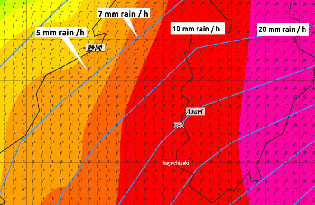
But for me more important is what is happening around MaRe. The next image shows the rain situation as forecasted by the GFS (weather) model. You can see the purple area extends from Tokyo to almost Arari; the forecast says that 3 h ago the same rain poured down on her. Water from above is not a problem it only cleans traces of craws liking to sit on top of the mast, where I don’t like them to sit.
What really concerns me is the wind around MaRe.
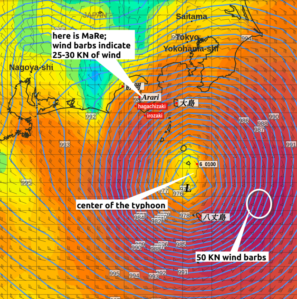
Above image shows the forecasted wind gusts for 16:00. The center of the typhoon is clearly to be seen. The light yellow color indicates already a very low wind speed and the barbs, the arrows with the feathers at the end indicate only 10-15 KN of wind. The center of every whirlwind has a very slow wind. However, outside of the center, the wind blows like hell. In the NE to SE sector the wind is forecasted with 50 KN, this is almost 100 km/h. A pretty strong wind, in which I never want to get in. At MaRe the wind gust are said to be 25 – 30 KN. This is reasonable and nothing should happen to her. Right now, looking a the forecast I am feeling a a bit relieved. This is caused by the fact the typhoon is moving NE, thus has passed MaRe already and it was not a strong typhoon.
However the TV news indicate that the real wind is 10-20 KN stronger than forecasted.
As trains are expected to run again tomorrow, I will see what happened to her.
***************
Some information about typhoon classes as they are used by the JTWC (Joint Typhoon Warning Center) and JMA (Japanese Meteorological Agency):
| Category | Wind Speed (kn) | Wind Speed (km/h) |
|---|---|---|
| Tropical Depression | < 34 kn | < 62 km/h |
| Tropical Storm | 34–63 kn | 62–117 km/h |
| Typhoon | 64–117 kn | 118–216 km/h |
| Very Strong Typhoon | 118–149 kn | 217–276 km/h |
| Super Typhoon | ≥ 150 kn | ≥ 277 km/h |
According to this table of JMA it is not really a typhoon but a Tropical Storm. But names don’t matter, only the windspeed.
Above table, I got quickly put together by Public AI, which is based is on Apertus, developed as part of the Swiss AI Initiative. This initiative is a collaboration between Swiss universities, including ETH Zurich and EPFL, and is supported by the Swiss National Supercomputing Centre (CSCS). Sometimes it is nicknamed “SwissGPT”.
Leave a Reply